mardi 23 mars 2010

Ko Samui Island In Thailand


Ko Samui Island
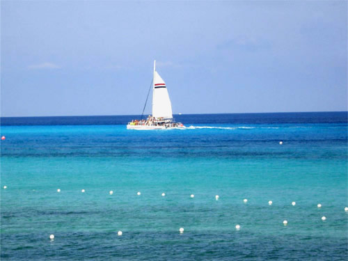
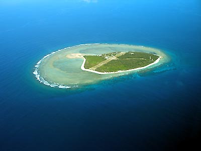
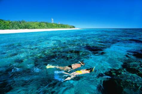
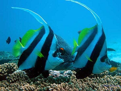
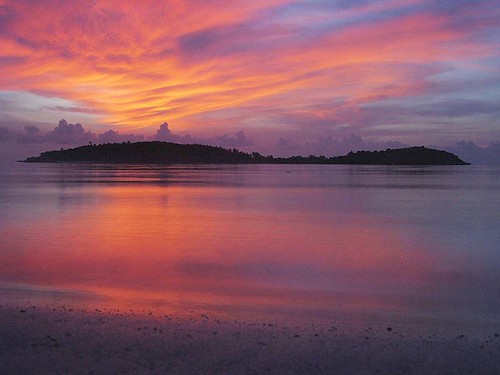
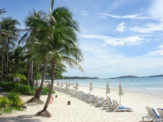
Ko Samui island of Surat Thani Province (or Koh Samui, Thai: เกาะสมุย), or often, simply Samui as it is referred to by locals, is an island off the east coast of the Kra Isthmus in Thailand, close to the mainland Surat Thani town. It is Thailand's third largest island, with an area of 228.7 km2 and a population of over 50,000 (2008). It is rich with natural resources, white sandy beaches, coral reefs and coconut trees.The island was probably first inhabited about 15 centuries ago, settled by fishermen from the Malay Peninsula and Southern China. It appears on Chinese maps dating back to 1687, under the name Pulo Cornam. The name Samui is mysterious in itself. Perhaps it is an extension of the name of one of the native trees, mui, or from the Chinese word Saboey, meaning "safe haven". Ko is the Thai word for "island."
Until the late 20th century, Ko Samui was an isolated self-sufficient community, having little connection with the mainland of Thailand. The island was even without roads until the early 1970s, and the 15 km journey from one side of the island to the other involved a whole-day trek through the mountainous central jungles.
Ko Samui has a population of about fifty-five thousand (source: Samui Mayor's Office) and is based primarily on a successful tourist industry, as well as exports of coconut and rubber. It even has its own international airport, Samui Airport, with flights daily to Bangkok and other major airports in Southeast Asia such as Hong Kong and Singapore. Whilst the island presents an unspoiled image to the public perception, economic growth has brought not only prosperity, but changes to the island's environment and culture, a source of conflict between local residents and migrants from other parts of Thailand and other countries. Reflecting Samui's growth as a tourist destination, the Cunard ship MS Queen Victoria (a 2000-plus passenger ship) docked at Samui during its 2008 world cruise.

Source : Wikipedia.com

lundi 22 mars 2010

Holbox Island In Mexican


Holbox Island
Holbox ("black hole" in Yucatec Maya) is an island in the Mexican state of Quintana Roo, located on the north coast of the Yucatán Peninsula. It is approximately 12 kilometers long and 1.5 kilometers wide, and separated from the mainland by a shallow lagoon that is home to flamingos, pelicans and other birdlife. It is part of the Municipality of Lázaro Cárdenas.
Not yet heavily touristed, the island's main industry is fishing. However, the island is developing a growing tourist industry in the form of whale shark viewing.
The island is accessed by ferry from the mainland town of Chiquila, and has virtually no cars, with transport by most residents and tourists by golf cart or moped. A small airline, Aerosaab, flies tours to Holbox from Cancún and Playa del Carmen; there is even a small airstrip to accommodate Aerosaab's five-seater Cessna aircraft.

Source : Wikipedia.com

dimanche 21 mars 2010

Lady Elliot Island In Australia


Lady Elliot Island
Lady Elliot Island is the southern-most coral cay of the Great Barrier Reef, Australia. The island lies 46 nautical miles (85 km; 53 mi) north-east of Bundaberg and covers an area of approximately 40 hectares (99 acres). The island is home to a small resort and airstrip, which is serviced daily by flights from Bundaberg, Hervey Bay, Maroochydore, Brisbane and the Gold Coast. Visitors to the resort can stay in a variety of accommodation, from suites to eco cabins. Activities on the island include reef walking, scuba diving, snorkelling and bird, turtle and whale watching. The island is particularly renowned for its scuba diving and snorkelling, as its location far offshore at the southern end of the Great Barrier Reef results in unrivalled water clarity.

Lady Elliot Island is an island resort on the Great Barrier Reef, and one of only three with direct flight access to the island airstrip. The island is located within the Great Barrier Reef Marine Park in the highest possible classification of Marine National Park Zone as designated by the Great Barrier Reef Marine Park Authority. Lady Elliot is an island teeming with life and live corals, famous for a transient population of up to 200 manta rays which form the iconic logo of the island's resort.

Source: Wikipedia.com

samedi 6 mars 2010

Overnight At Gili Nanggu Lombok


Gili Nanggu Lombok

The island of 12,5 Ha area in Western Lombok is managed with Forest/Virgin Island concepts of unexploited nature. The serenity and beauty of this island makes Gili Nanggu a routine destination for many foreign tourists. They call Gili Nanggu: “The Paradise Island” It’s pristine beauty is a magnet to come and play at the beach everyday. and natural silence during sunset- creating a romantic atmosphere, making Gili Nanggu a suitable place for couples to enjoy their honeymoon.

vendredi 5 mars 2010

Kuta On Lombok


Kuta Beach Island In Lombok

Kuta is administratively a district (kecamatan) and subdistrict/village (kelurahan) in southern Bali, Indonesia. A former fishing village, it was one of the first towns on Bali to see substantial tourist development, and as a beach resort remains one of Indonesia's major tourist destinations. It is known internationally for its long sandy beach, varied accommodation, many restaurants and bars, and many renowned surfers who visit from Australia. It is located near Bali's Ngurah Rai Airport.
Kuta was the site of the October 12, 2002 1st Bali bombing (202 killed) and the October 1, 2005 2nd Bali bombing (26 killed).
The Balinese Provincial Government have taken the view that the preservation of the Balinese culture, natural resources and wildlife are of primary importance in the development of the island. To this end they have limited tourist development to the peninsula on the extreme southern aspect of the island; Kuta beach is on the western side of this peninsula and Sanur is on the east. To the north of the peninsula no new tourist development is supposedly permitted.[citation needed].
To the south, Kuta Beach extends beyond the airport into Jimbaran. Other nearby towns and villages include Seseh (6.4 nm), Denpasar (4.5 nm), Ujung (1.8 nm), Pesanggaran (2.0 nm), Kedunganan (2.9 nm) and Tuban (1.0 nm).

Source : Wikipedia.com

mercredi 3 mars 2010

Senaru in North The Lombok


Senaru image

Lombok (population 2,950,105 in 2005) is an island in West Nusa Tenggara province, Indonesia. It is part of the chain of the Lesser Sunda Islands, with the Lombok Strait separating it from Bali to the west and the Alas Strait between it and Sumbawa to the east. It is roughly circular, with a "tail" to the southwest, about 70 km across and a total area of about 4,725 km² (1,825 sq mi). The provincial capital and largest city on the island is Mataram.

Source : Wikipedia.com

mardi 2 mars 2010

Mount Rinjani World Travel


Mount Rinjani In Lombok

Mount Rinjani or Gunung Rinjani is an active volcano in Indonesia on the island of Lombok. It rises to 3,726 m (12,224 ft), making it the second highest volcano in Indonesia, and similar in height to Mount Fuji. The first historical eruption occurred in September 1847. The most recent eruption of Mount Rinjani was on 10 May 2009. The volcano had started erupting again on 27 April 2009, and the mountain was closed as the eruptions intensified with plumes of smoke and ash as high as 8,000 m.

The 6 km by 8.5 km oval-shaped caldera is filled partially by a crater lake known as Segara Anak ('Child of the Sea') and is approximately 2000m above sea level and estimated at being around 200m deep); the caldera also contains hot springs. The eruptions of 1994, 1995, and 1996 have formed a small cone, Gunung Baru (or 'New Mountain' - approximately 2300m above sea level) in the center of the caldera and lava flows from these eruptions have entered the lake. This cone has since been renamed Mount Barujari (or 'New Finger').

The highlands are forest clad and mostly undeveloped. The lowlands are highly cultivated. Rice, soybeans, coffee, tobacco, cotton, cinnamon, and vanilla are the major crops grown in the fertile soils of the island.

The volcano and the caldera are protected by the Gunung Rinjani National Park established in 1997. Tourism is increasingly popular with trekkers able to visit the rim, make their way into the caldera or even to make the more arduous climb to the highest point; fatalities, however, are not uncommon. As of July 2009 the summit route was closed due to volcanic activity.

Source : Wikipedia.com