mardi 13 avril 2010

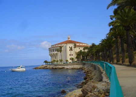
Santa Catalina Island California


Santa Catalina Island

Santa Catalina Island, often called Catalina Island, or just Catalina, is a rocky island off the coast of the U.S. state of California. The island is 22 miles (35 km) long and eight miles (13 km) across at its greatest width. The island is located about 22 miles (35 km) south-southwest of Los Angeles, California. The highest point on the island is 2097 ft (639 m) Mt. Orizaba, at 33°22′29.7″N 118°25′11.6″W / 33.374917°N 118.419889°W / 33.374917; -118.419889.
Part of the Channel Islands of California archipelago, Catalina falls under the jurisdiction of Los Angeles County. Most of the island is owned by the Catalina Island Conservancy.
The total population as of the 2000 census was 3,696 persons with almost 85 percent living in its only city of Avalon (pop. 3,127, with another 195 south of the city outside of the city limits). The second center of population is the unincorporated town of Two Harbors, in the north, with a population of 298. Development occurs also at the smaller settlements Rancho Escondido and Middle Ranch. The remaining population is scattered over the island between the two population centers. The island has an overall population density of 49.29/mi² (19.03/km²).

Source : Wikipedia.com

lundi 12 avril 2010

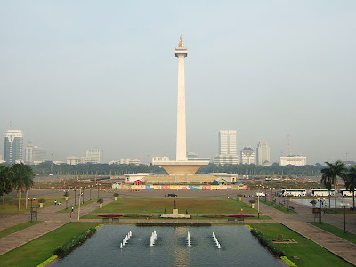
National Monument Tower in Central Jakarta


National Monument (MONAS) in Jakarta

The National Monument (Indonesian: Monumen Nasional (Monas)) is a 422 ft (128.7 m) tower in Central Jakarta, symbolizing the fight for Indonesia's independence. Construction began in 1961 under the direction of President Sukarno and the monument was opened to the public in 1975. It is topped by a flame covered with gold foil.After the Indonesian government returned to Jakarta from Yogyakarta in 1950 following the Dutch recognition of Indonesian independence, President Sukarno began to contemplate the construction of a national monument comparable to the Eiffel Tower on the square in front of the presidential palace. On 17 August 1954, a National Monument Committee was established and a design competition was held in 1955. This attracted 51 entries, but only one design, by Frederich Silaban, met any of the criteria determined by the committee, which included reflecting the character of Indonesia in a building capable of lasting for centuries. A repeat competition was held in 1960, but once again, none of the 136 entries met the criteria. The chairman of the jury team then asked Silaban to show his design to Sukarno. However, Sukarno did not like the design as he wanted the monument to be in the form of a linga and yoni. Silaban was asked to design such a monument, but his design was for a monument so large that it would have been unaffordable given the economic conditions at the time. Silaban refused to design a smaller monument, suggesting that construction be delayed until the Indonesian economy improved. Sukarno then asked the architect R.M. Soedarsono to continue with the design. Soedarsono incorporated the numbers 17, 8 and 45, representing the 17 August 1945 Proclamation of Indonesian Independence, in the dimensions of the monument.

Source : WIkipedia.com

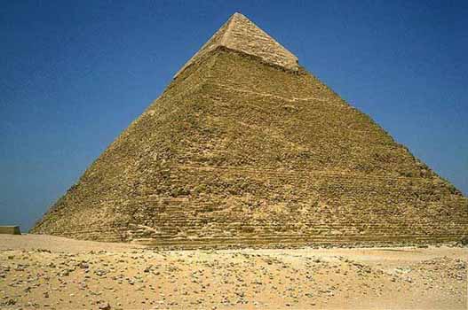
Pyramid of Khafre World Travel


Pyramid of Khafre World Travel

The Pyramid of Khafre is the second largest of the Ancient Egyptian Pyramids of Giza and the tomb of the fourth-dynasty pharaoh Khafre (Chephren).The pyramid was likely opened and robbed during the First Intermediate Period. During the 18th dynasty the overseer of temple construction robbed casing stone from it to build a temple in Heliopolis on Rameses II’s orders. Arab historian Ibn Abd as-Salaam recorded that the pyramid was opened in 1372. It was first explored in modern time by Giovanni Belzoni on March 2, 1818 and the first complete exploration was conducted by John Perring in 1837.

Source : Wikipedia.com